
Methodology
To identify suitable areas for seed potato production in Indonesia, we have selected several land use and terrain characteristics which define suitability conditions to produce seed potatoes.
These characteristics have been sourced from available global raster maps with a resolution of 30 arcsec and a pixel size of approximately 1 km2 at the equator. Data from these maps have been combined with criteria (or thresholds) to distinguish (un)suitable areas. Our results are presented in one of the following ways: (a) as a map depicting the locations of the suitable areas (with 30 arcsec resolution), (b) in tables after aggregation of pixel values to province level, and (c) as figures illustrating the effects of various thresholds.
The following data have been used in our assessment:
- Median elevation in a pixel in meters above sea level (masl) from the Harmonized World Soil Database (HWSD v1.21).
- Percentage area in a pixel belonging to two slope classes (0 – 0.5% and 0.5 – 2.0%) from the Harmonized World Soil Database (HWSD v1.21).
- Percentage area in a pixel under cropland from a spatial cropland distribution map (Fritz et al., 2015).
The two slope maps have been combined to obtain a map with slopes of less than 2%. Based on expert knowledge, the following three criteria (or thresholds) with respect to above data have been used to identify and map suitable areas:
- Land should be at least 1400 masl to provide sufficiently cool conditions minimizing the threat of aphids that transmit harmful viruses;
- Land should be relatively flat, i.e. the slope of the terrain should not exceed 2% to reduce the risk of soil erosion.
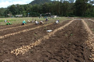
- Land should currently be used as cropland to avoid that nature areas or urban areas are included in the suitability assessment.
Because flat land above 1400 masl is scarce in Indonesia, we also show results using a less strict criterion, i.e. land above 1200 masl. This allows to show the effect of loosening the elevation criterion on the assessment of the area suitable for seed potato production.
Procedure
We used the following procedure to combine the maps and the criteria to determine the potentially suitable areas for seed potato production in Indonesia:
First, we have selected pixels with a median elevation above 1400 masl (or 1200 masl). The cropland area in these pixels has been multiplied with the percentage area in each pixel with a slope of less than 2%, being a minimum estimate of the potentially suitable area. This option assumes that the slope class (< 2%) is represented in the cropland area according to its distribution in the whole pixel.
The second option assumes that the cropland area is preferentially located at the flatter parts of a pixel. For that situation, the cropland area and the relatively flat area of a pixel (with slopes < 2%) are compared and the minimum of both values is taken. This value represents our maximum estimate for the potentially suitable area, because it can be as large as the cropland area in a pixel if sufficient relatively flat area is available in a pixel.
As the actual cropland distribution within a pixel is unknown, we have calculated the average of the minimum and maximum values per pixel, and present that as potentially suitable area for seed potato production. Aggregation of these pixel values gives the total potentially suitable areas at provincial and national levels of Indonesia.